|
SEE ALSO:
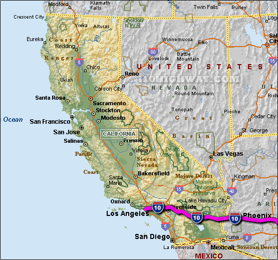
i-10 California Traffic Map.
The i-10 travels across California in generally a east - west direction ... at
it's western most point, the i-10 begins/ends on the west coast of California in
the city of Santa Monica near the Pacific Ocean ... travelling east on the i-10
across California; the i-10
travels into the state of Arizona.
The total distance of the i-10 across the state of California is approx. 243
miles long, which requires an approx. driving time of 4 hours and 3 minutes to complete when driving an average speed of 60 miles
per hour.
See also: Regional i-10 California traffic maps;
Baldwin Park,
Banning,
Beaumont,
Blythe,
Calimesa,
Claremont,
Colton,
Covina,
Culver City,
East Los Angeles,
El Monte,
Fontana,
Indio,
Los Angeles,
Montclair,
Monterey Park,
Ontario,
Palm Desert,
Palm Springs,
Pomona,
Rancho Cucamonga,
Redlands,
Rosemead,
San Bernardino,
Santa Monica,
Upland,
and West Covina.
|