|
SEE ALSO:
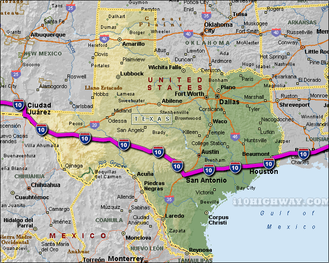
i-10 Texas Traffic Map.
The i-10 travels across Texas in generally a east - west direction
... to the east; the i-10 travels into the state of
Louisiana,
and to the west; the i-10
travels into the state of New Mexico.
The total distance of the i-10 across the state of Texas is approx. 879 miles
long, which requires an approx. driving time of 14 hours and 39 minutes to complete when driving an average speed of 60 miles
per hour.
See also: Regional i-10 Texas traffic maps;
Beaumont,
Boerne,
Brookshire,
Channelview,
Cloverleaf,
Columbus,
Comfort,
El Paso,
Fabens,
Flatonia,
Fort Hancock,
Fort Stockton,
Houston,
Jacinto City,
Junction,
Katy,
Kerrville,
Kirby,
Lakewood,
Luling,
Lynchburg,
Montoya,
Orange,
Ozona,
Pinehurst,
San Antonio,
Schulenburg,
Sealy,
Seguin,
Sonora,
Van Horn,
Vidor,
Walden,
Weimar,
Westway,
and
Winnie.
|